Three Rivers Fire Morning Update: April 28, 2021
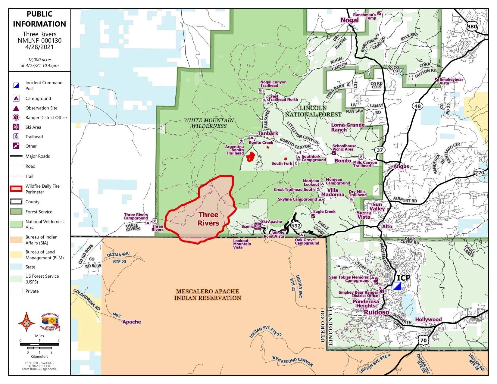
Fire Update: The Type-1 Incident Management Team took command of the fire at 6 am this morning. Crews have been divided into three divisions and will be focusing on constructing a fire line on the south end of the fire, working their way to the east and north. The southeastern portion of the fire is in particularly rough terrain, making firefighter’s work even more challenging for every mile of fire line they build. Despite harsh conditions, this area remains a top priority because of the multiple values at risk ahead of the fire, including homes and Ski Apache.
Firefighter safety remains a serious concern given the White Mountain Wilderness’s rough terrain and limited access. When considering how to fight a fire, Fire Management personnel must consider how to safely get firefighters in and how to get them out in case of an emergency.
Rain and snow are falling again today, which is lessening fire activity. Up to a ½ inch of rain is expected on a portion of the fire. Precipitation and higher humidity levels around 30 percent will slow the fire, however, winds are still expected to be erratic along the mountain ridges.
The fire has burned into the Little Bear Fire Scar, where there is less vegetation to burn, but drier fuels (aka logs and grasses) on the forest floor. Fuel moisture levels for the dead and down wood in this area of the fire are at 7 percent compared to a normal of 17 percent for this time of year.
Acreage Explained: Yesterday, new acres were reported at 12,000. The 12,000-acre number represents the entire fire perimeter; however, there are large portions of unburnt forest encompassed within the larger fire perimeter. Today, first-hand firefighter knowledge from the field and geospatial technicians who arrived with the team will use up-to-date data and mapping technology to pinpoint both the main fire and smaller spot fires. We expect this number to decrease. Updated acreage will be released later today.
The fire crossed onto the northern section of Mescalero Apache Tribal Land. Mescalero and the Forest Service are now working in conjunction with fire management activities. The fire remains at 5 percent contained. There are no reported injuries, and no structures have burned.
Smoke: Smoke from the fire will be most intense in the afternoon. Smoke will be visible from Highway 54 and will move to the northeast into Alto, Capitan, and Ruidoso communities. Those with respiratory conditions are encouraged to stay indoors with the windows closed and use an air conditioner with a filter if possible.
Evacuations: Evacuation notices have been lifted in the following areas.
• Nogal Canyon Area (until the Nogal Peak Trailhead)
• Bonito Canyon Area up to the Bonito Lake Dam. Tanbark remains evacuated.
• Church Mountain
• Ranchman’s Camp
• Loma Grande
• Cora Dutton
• Magado
• Ski Apache Up to the Eagle Lakes turn
• Villa Madonna
RESIDENTS SHOULD REMAIN VIGILANT AND PREPARED FOR EVACUATIONS IN THESE AND ADDITIONAL AREAS IF FIRE BEHAVIOR INCREASES.
Road Closures
• Bonito Canyon Road past the Bonito Lake Dam
• Nogal Canyon Road past the Nogal Peak trailhead
• Three Rivers Trailhead and Campground
• Monjeau Lookout at Sierra Vista
You can expect another post this evening.
For more information on the fire, please tune in to 1490 AM KRUI - The Mountain or visit Three Rivers Fire 2021.

